Log in
All resources
Create a design
1,096,168 Free Images of Maps Of Bern
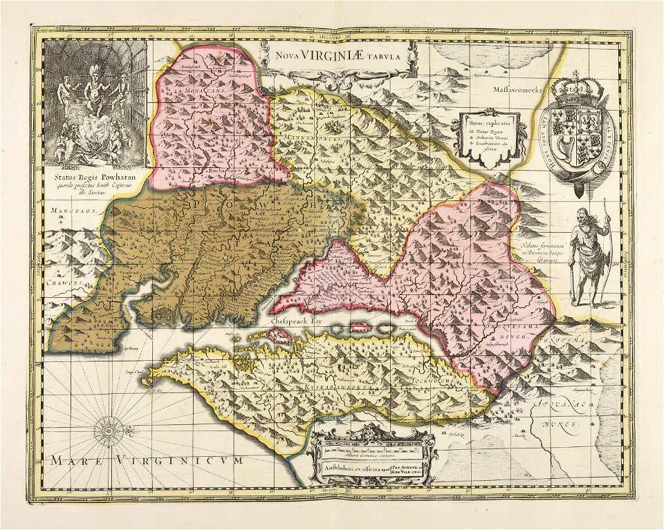
maps made in the 17th century
maps by pieter schenk (i)
gerard valck
atlantis magni tomus quartus (biblioteca comunale di trento)
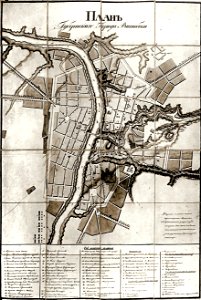
historical images of viciebsk
maps of viciebsk
atlantis magni tomus quintus (biblioteca comunale di trento)
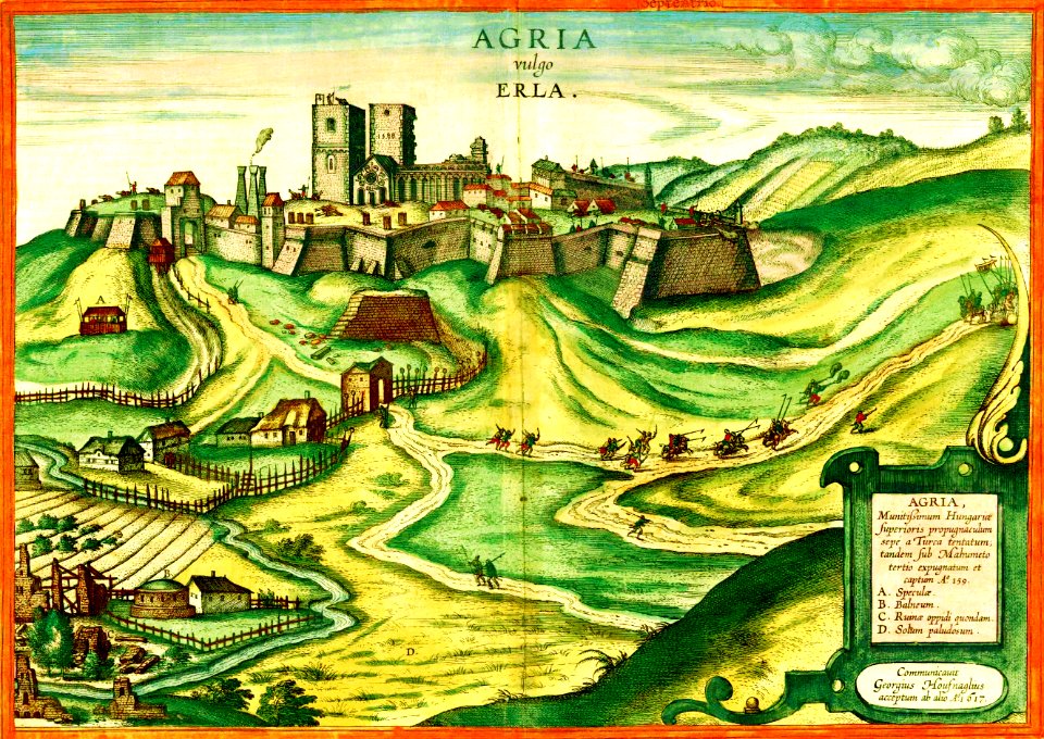
braun & hogenberg
fonds ancely - bibliothèque municipale de toulouse - maps
victor levasseur - maps of france
history of ratzeburg
1730 maps of germany
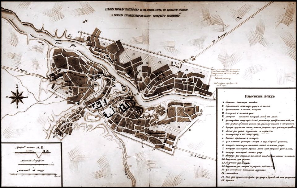
historical images of viciebsk
maps of viciebsk
historical images of viciebsk
maps of viciebsk
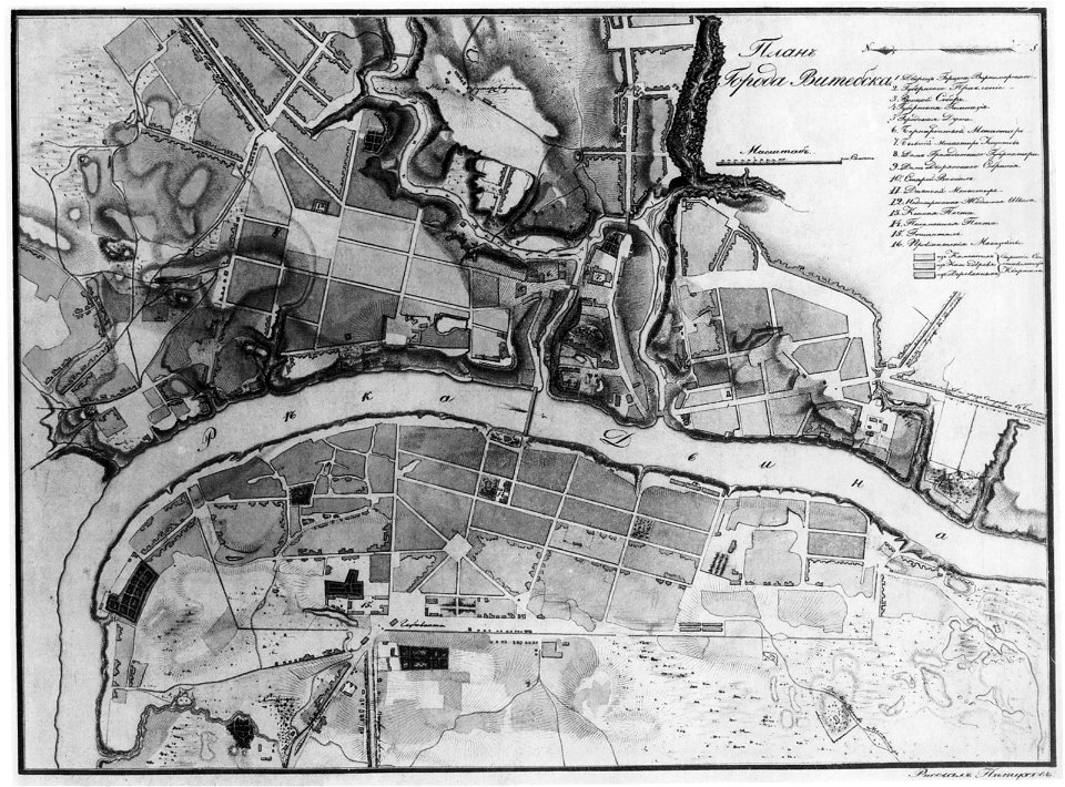
historical images of viciebsk
maps of viciebsk
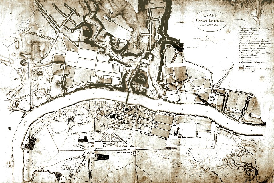
historical images of viciebsk
maps of viciebsk
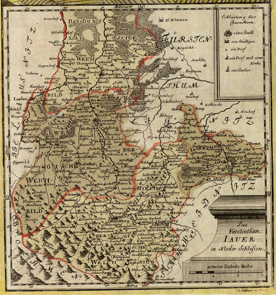
old maps of silesia
duchy of jauer
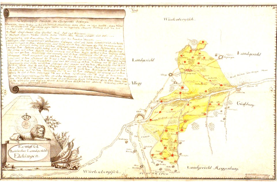
history of elchingen
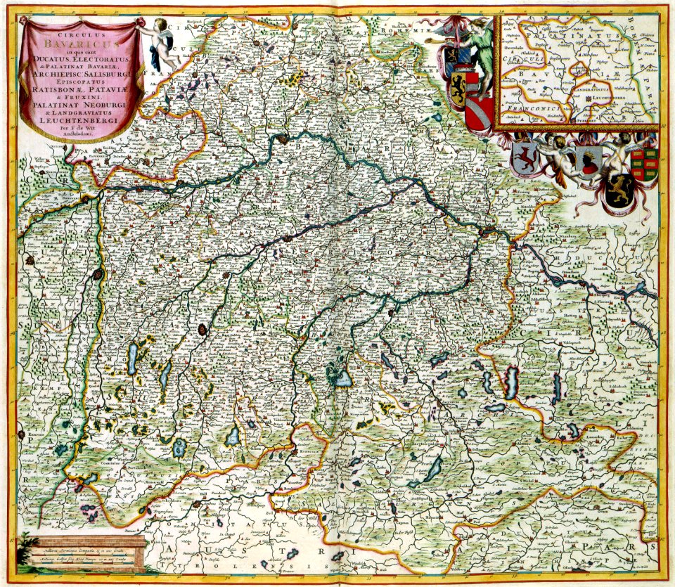
old maps of bavaria
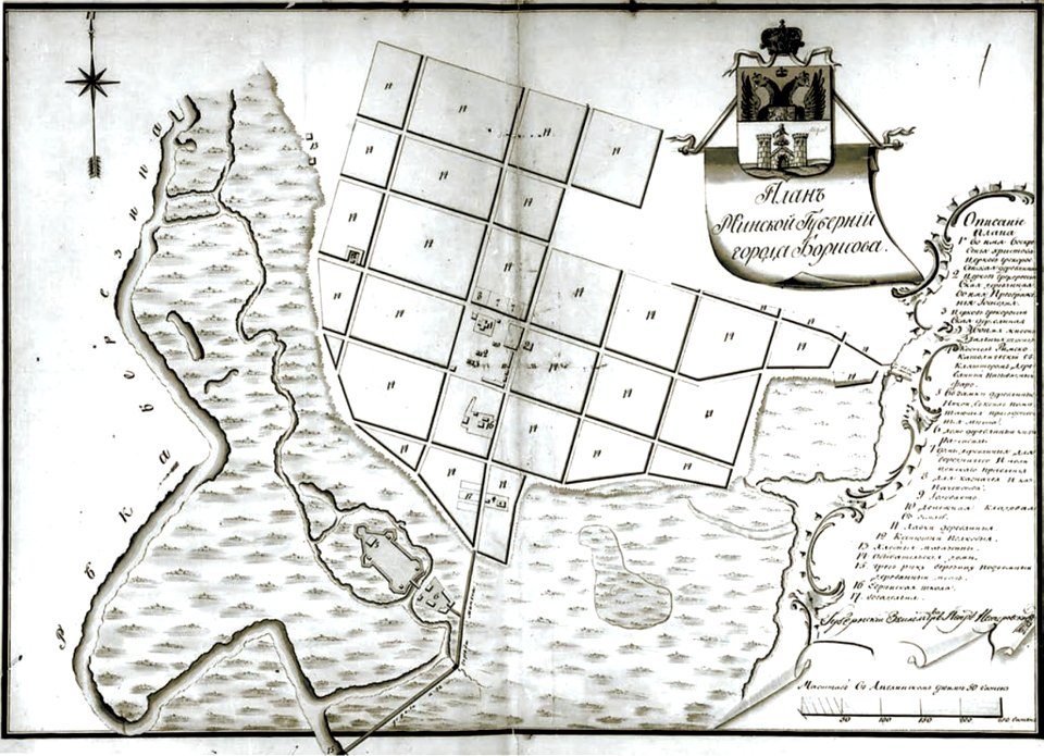
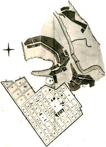
historical images of barysaŭ
maps of barysaŭ
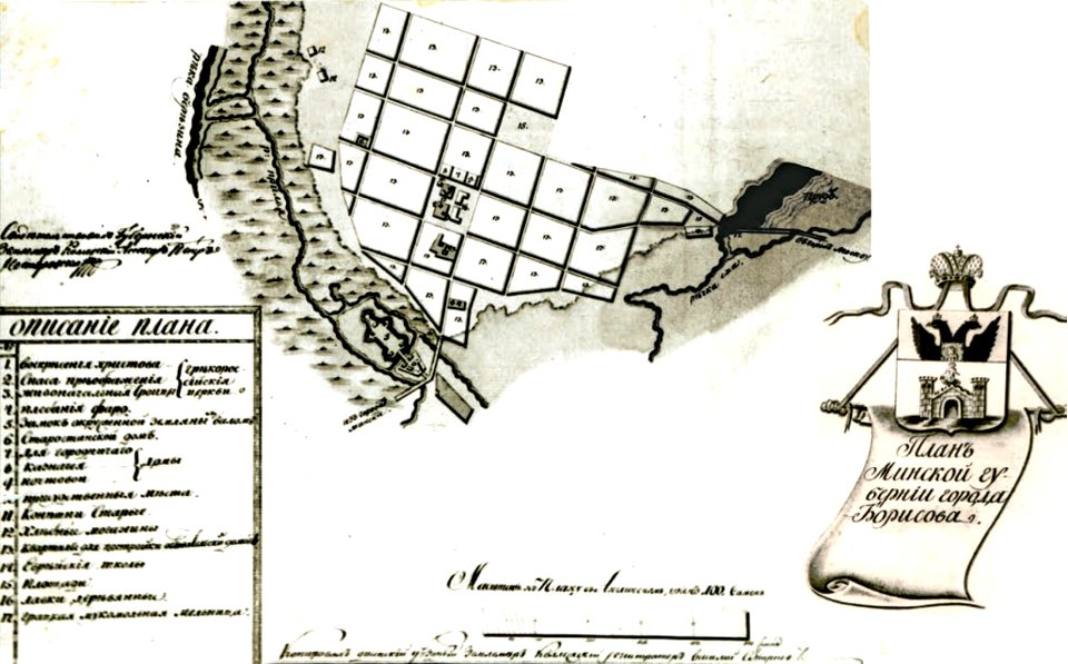
historical images of barysaŭ
maps of barysaŭ
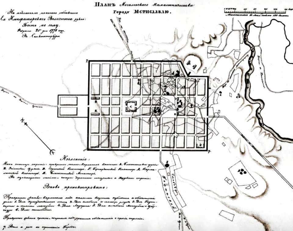
historical images of mscislaŭ
maps of mscislaŭ
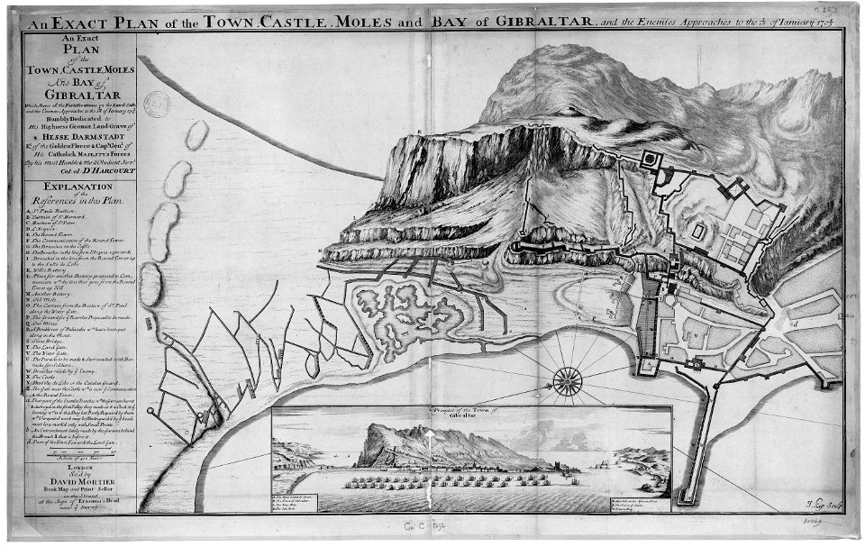
old maps of gibraltar
capture of gibraltar
historical images of mscislaŭ
maps of mscislaŭ
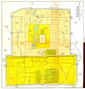
old maps of beijing
history of beijing
müller's map of moravia
maps of příbor
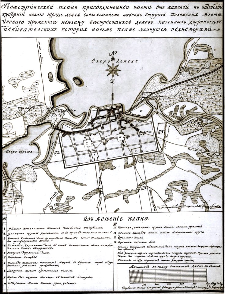
historical images of lepiel
maps of liepieĺ
historical images of lepiel
maps of liepieĺ
historical images of pinsk
maps of pinsk
historical images of pinsk
maps of pinsk
historical images of homel
maps of homieĺ
historical images of sluck
maps of sluck
historical images of słonim
maps of slonim
historical images of čerykaŭ
maps of čerykaŭ
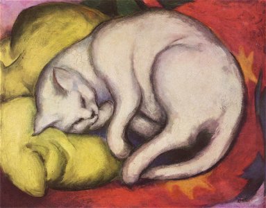
expressionist painting
1912 paintings
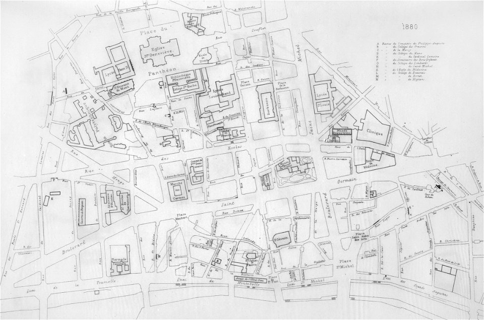
lithographs of paris
université de paris
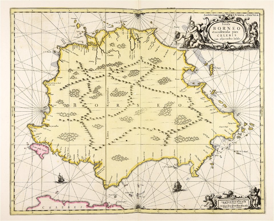
maps made in the 17th century
gerard valck
maps made in the 17th century
gerard valck
maps made in the 17th century
gerard valck
maps by nicolaes visscher i
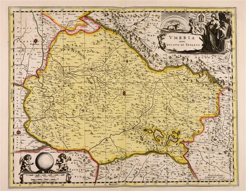
old maps of upper austria
maps by frederick de wit
maps with cartouches
maps made in the 17th century
gerard valck
maps made in the 17th century
maps by pieter schenk (i)
maps made in the 17th century
gerard valck
maps made in the 17th century
gerard valck
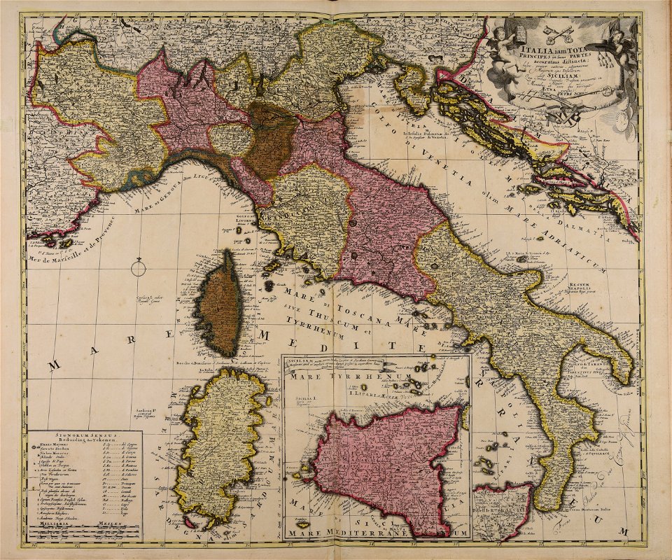
maps made in the 18th century
18th-century maps of italy
maps made in the 17th century
gerard valck
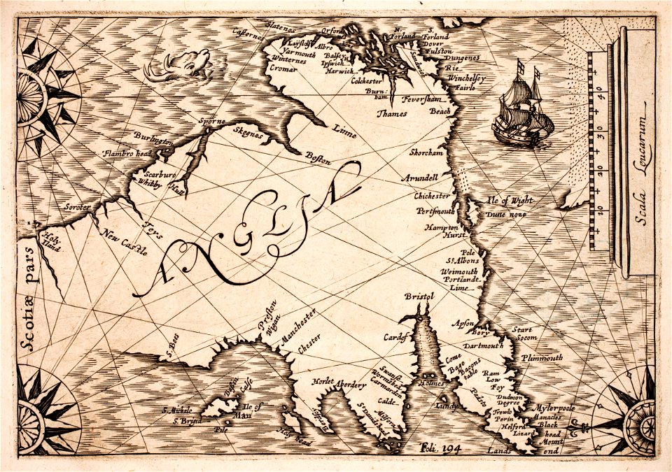
prints from selden mare clausum at the peace palace library
1636 maps of england
maps by matthäus seutter
history of celle
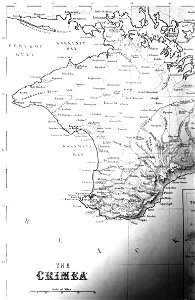
old maps of crimea
1856 maps
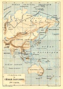
illustrations from césar cascabel by george roux
césar cascabel
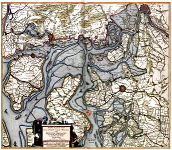
old maps of zeeland
atlas van der hagen
atlas van der hagen
old maps of france
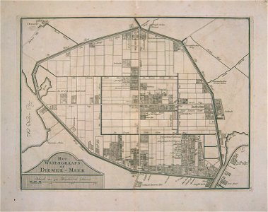
watergraafsmeer
diemen
watergraafsmeer
diemen
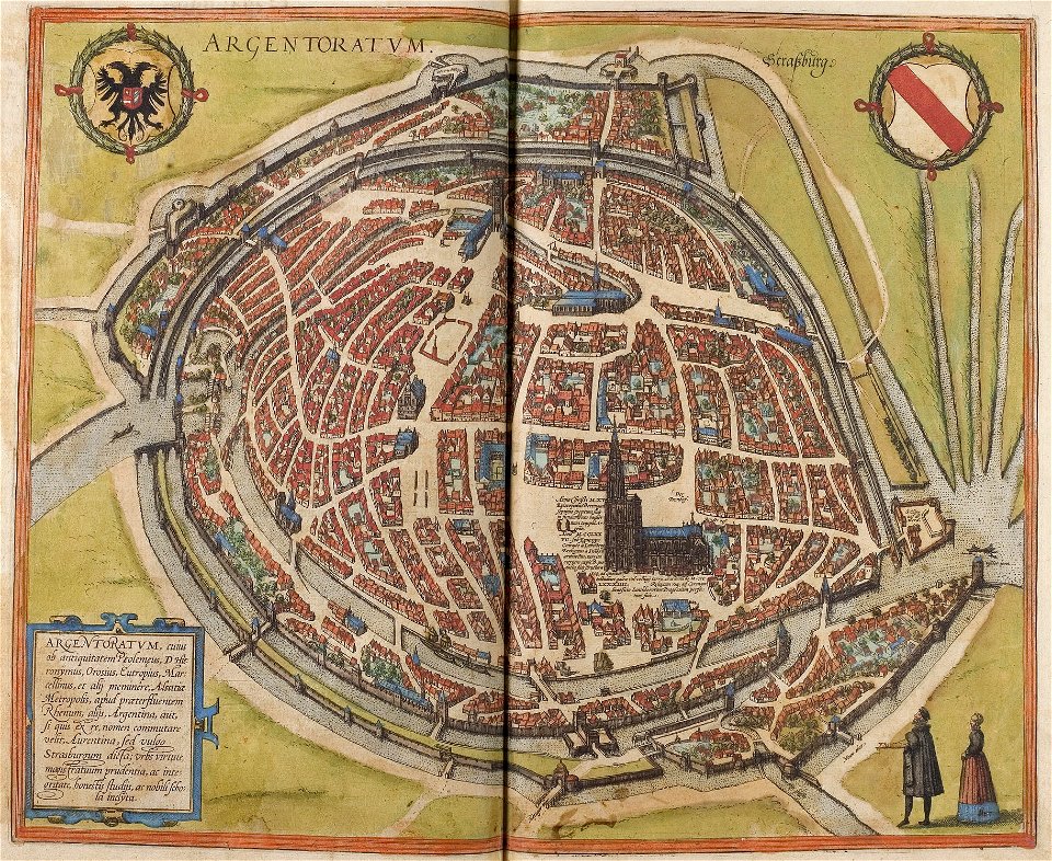
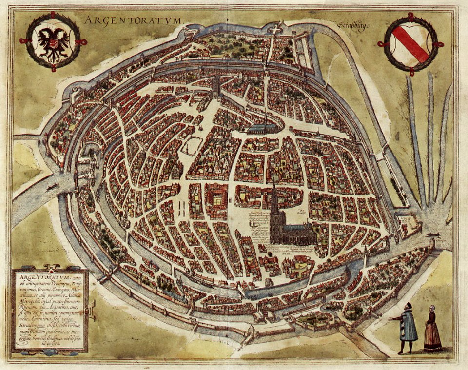
maps of strasbourg in the 16th century
braun & hogenberg
maps of strasbourg in the 16th century
braun & hogenberg
17th-century maps of the caribbean
1622
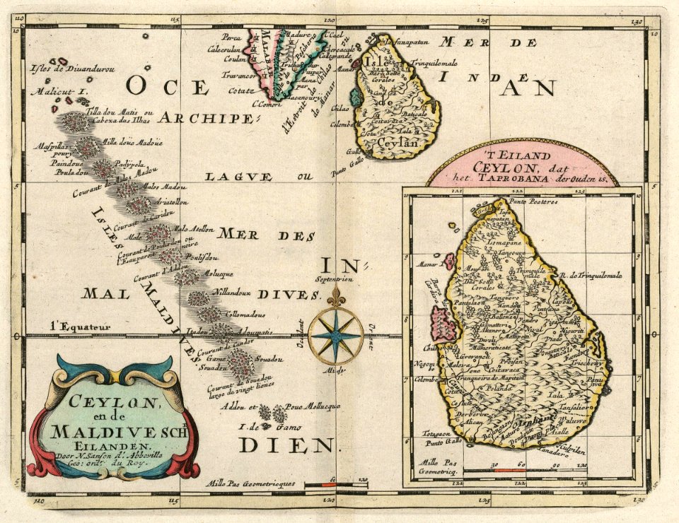
maps of the dutch east india company - sri lanka
1705
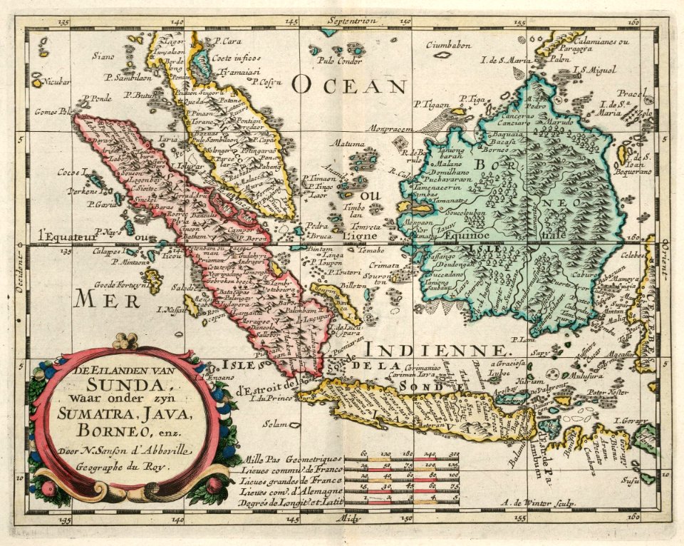
maps of the dutch east india company - indonesia
1705
maps of the west-indische compagnie
1644
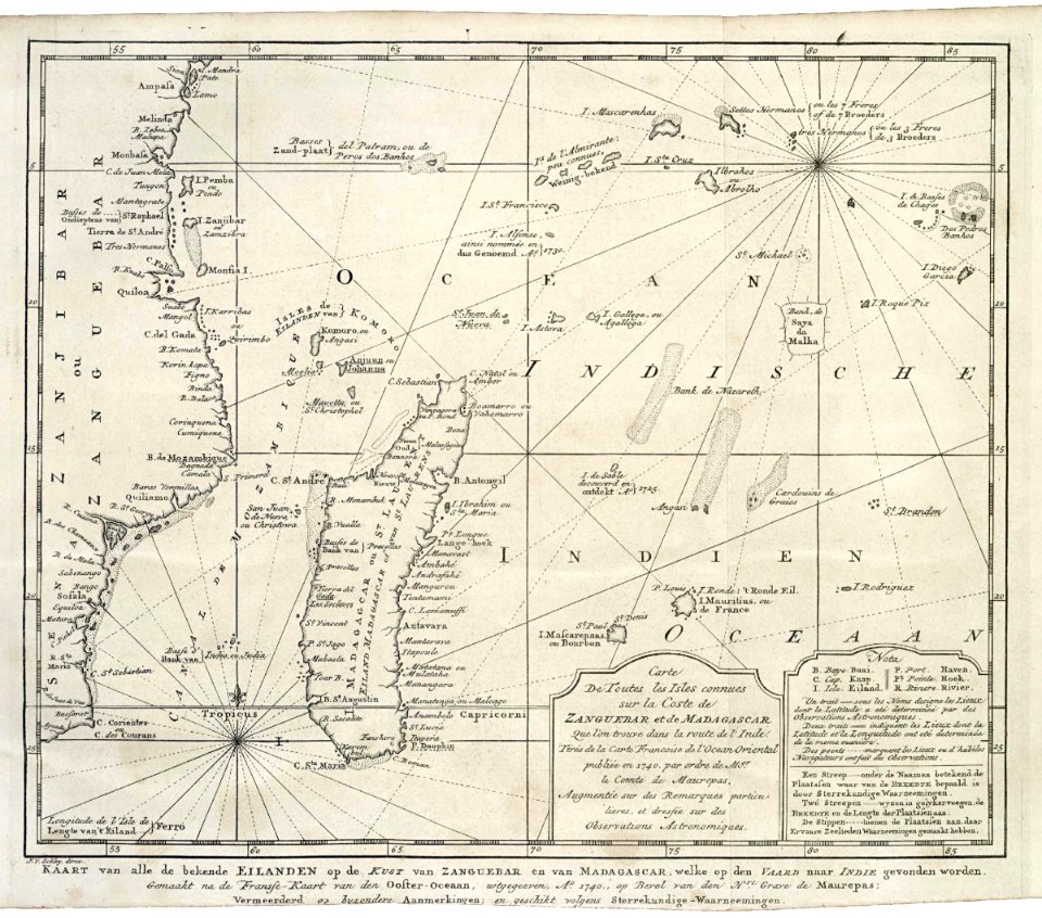
maps of the dutch east india company - madagascar
1747)
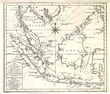
maps of the dutch east india company - indonesia
1747)
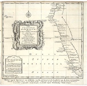
old maps of the dutch east india company
1747)
atlas de wit 1698
frederick de wit
old maps of the holy land
old maps of palestine
old maps of mediterranean sea
levantine sea
19th-century maps of bavaria
wertach river in augsburg
old maps of japan
old maps of korea
old maps of north america from the norman b. leventhal map center
1755 maps of the united states
media from national cancer institute visuals online
maps of the united states
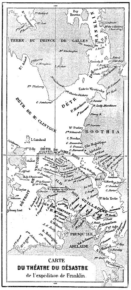
john franklin's lost expedition
volume 1 of le tour du monde
maps by jacob van deventer
old maps of roermond
hand-drawn maps and views of world war i battlefields by h.m.
old maps of the english channel
media in the houghton library
harvard university
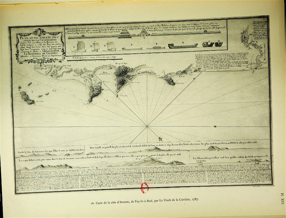
old maps of vietnam
nguyễn lords
atlantis magni tomus primus (biblioteca comunale di trento)
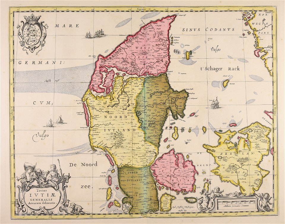
17th-century maps of denmark
maps in the library of congress
new york
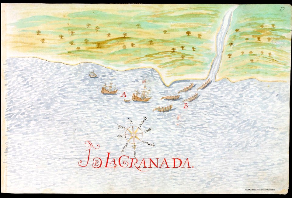
old manuscript maps
pictorial maps
maps and topographical views by joris hoefnagel
braun & hogenberg
maps made in the 17th century
maps by nicolaes visscher i
johann baptist homann
maps
1726
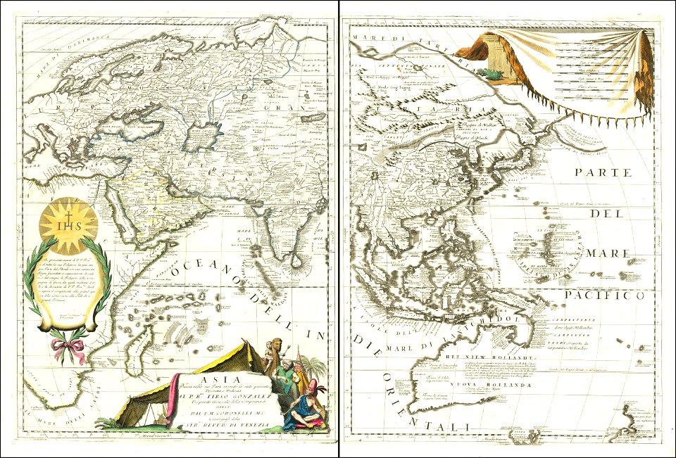
asie
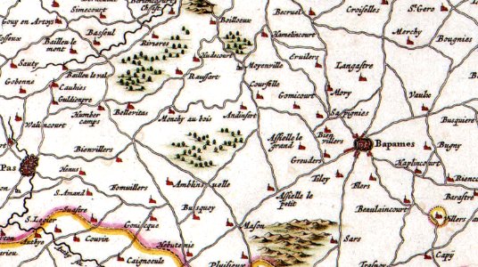
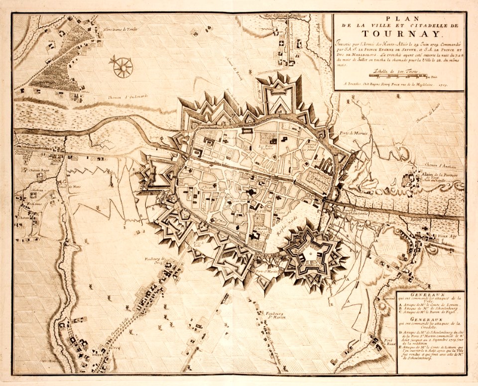
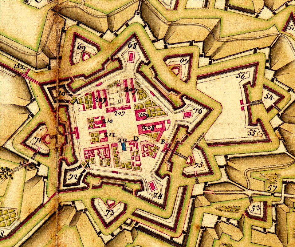
old maps of tournai
tournai
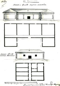
fonds ancely - bibliothèque municipale de toulouse - maps
louis-marie de la révellière-lépeaux
fonds ancely - bibliothèque municipale de toulouse - maps
victor levasseur - maps of france
fonds ancely - bibliothèque municipale de toulouse - maps
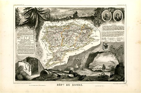
coats of arms of cities in doubs
roch-ambroise cucurron sicard
frédéric-auguste laguillermie
collections de la bibliothèque nationale et universitaire de strasbourg
maps of strasbourg in the 18th century
drawings by john robert cozens in the yale center for british art
old maps of lazio
plaek phibunsongkhram
thailand
a history of land mammals in the western hemisphere (1913)
robert bruce horsfall
merksem
lillo
maps made in the 17th century
gerard valck
charles xiv john as crown prince of sweden (françois gérard)
details of 19th-century portrait paintings
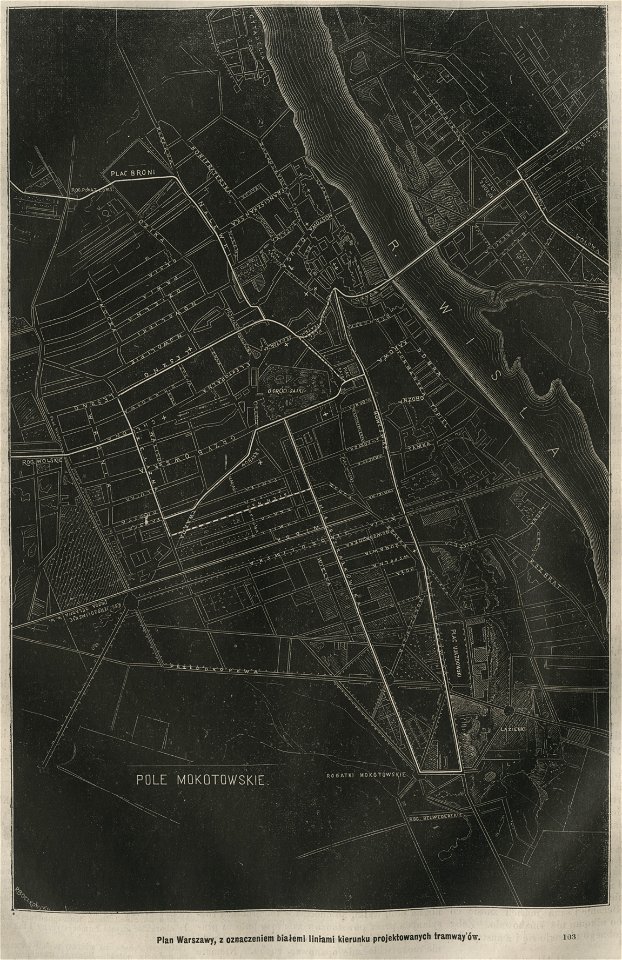
trams in warsaw
maps of warsaw
joan blaeu
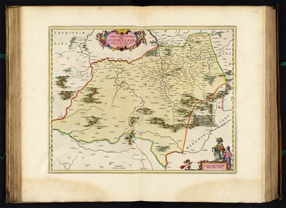
vogtland
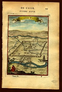
description de l'universe
maps of nineveh
maps in the library of congress
maps in the library of congress
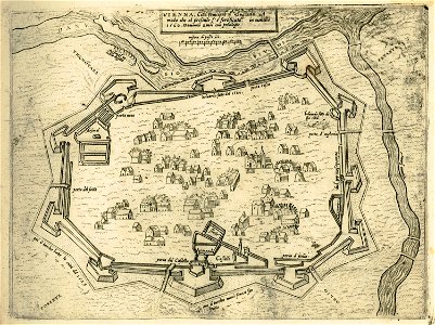
old maps of vienna
giovanni camocio
description de l'universe
maps of nineveh
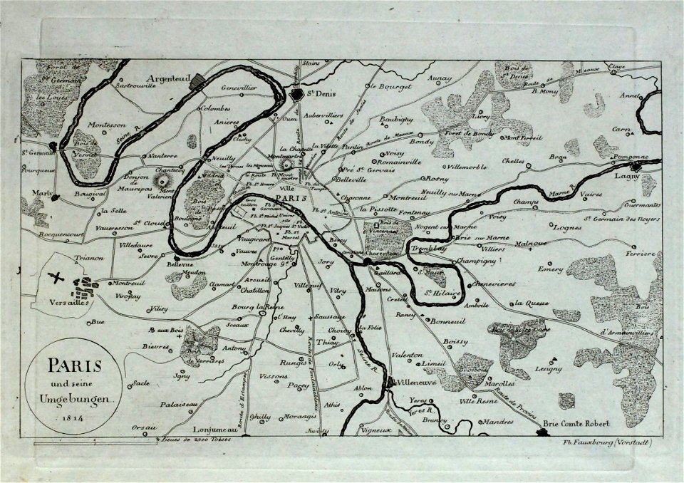
old maps of île-de-france
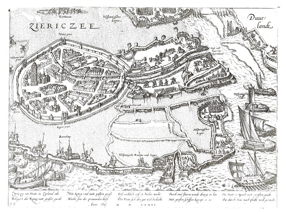
old maps of zierikzee
braun & hogenberg
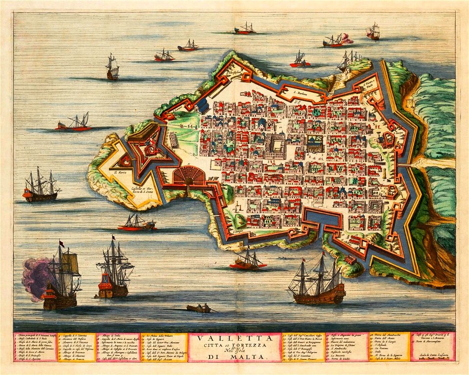
old maps of valletta
joan blaeu
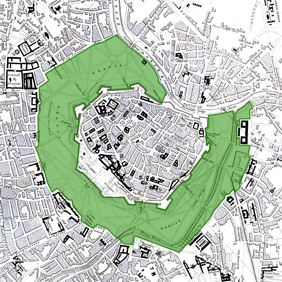
vienna
glacis
vincenzo coronelli
1690s maps of asia
old maps of italy
olfert dapper
bird's eye view maps of pennsylvania
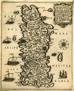
old maps of crete
giovanni camocio
1877 maps of europe
political cartoons
old maps of bergamo
alvise cima
4601 - 4700 of 1,096,168
Next page
/ 10962